
Land & Engineering Survey
Get the measurements right, and everything else follows
We deliver accurate field measurements and documentation that de-risk planning, construction, and compliance. Our team combines modern GNSS, total station, and drone methods with disciplined QA to give you results you can build on.
Typical deliverables
- Boundary / cadastral / subdivision surveys
- Topographic & as-built surveys
- Construction set-out & control networks
- Drawings (DWG/PDF) and GIS/CSV exports
Outcomes for you
- Planning approvals without rework
- Fewer site surprises during construction
- Traceable records for registration

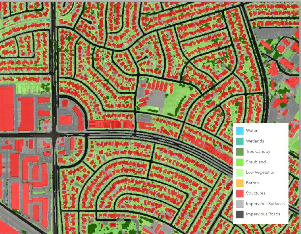
Remote Sensing & Earth Observation
See change, risk, and opportunity—at scale
We process satellite and drone imagery to map assets, monitor change, and surface actionable signals. From vegetation and land-cover to construction progress and hazard assessment, we turn pixels into decisions.
We handle the hard parts
- Imagery sourcing & licensing
- Radiometric/atmospheric correction & mosaics
- Feature extraction & change detection
- Web dashboards for stakeholders
Use cases
- Environmental monitoring & compliance
- Agriculture & forestry insights
- Infrastructure & construction oversight
AI & Machine Learning
Purpose-built models that answer spatial questions
When rules aren’t enough, we build and deploy ML models that classify imagery, predict outcomes, and automate geospatial workflows. We prefer interpretable, production-ready pipelines over black-box demos.
Our approach
- Data labeling & quality control
- Model selection (RF, KNN, CNN) & validation
- Explainability and performance tracking
- Deployment to APIs & map apps
What you get
- Repeatable pipelines & versioned artifacts
- Readable documentation & handover
- Clear metrics tied to business outcomes
GIS & Geodatabases
Maps, apps, and data pipelines that people actually use
We design geodatabases, build web maps, and automate data refresh so teams can trust their spatial information. Governance, security, and usability are baked in from day one.
Capabilities
- Schema design & data migration
- ETL pipelines & scheduled updates
- Role-based web apps & dashboards
- Cloud & on-prem deployment
Business value
- Single source of truth for assets & land
- Faster decisions with self-serve tools
- Lower manual effort and errors
Have a problem you’re mapping or measuring?
Tell us what you’re trying to achieve. We’ll suggest an approach, timeline, and a clear set of deliverables.