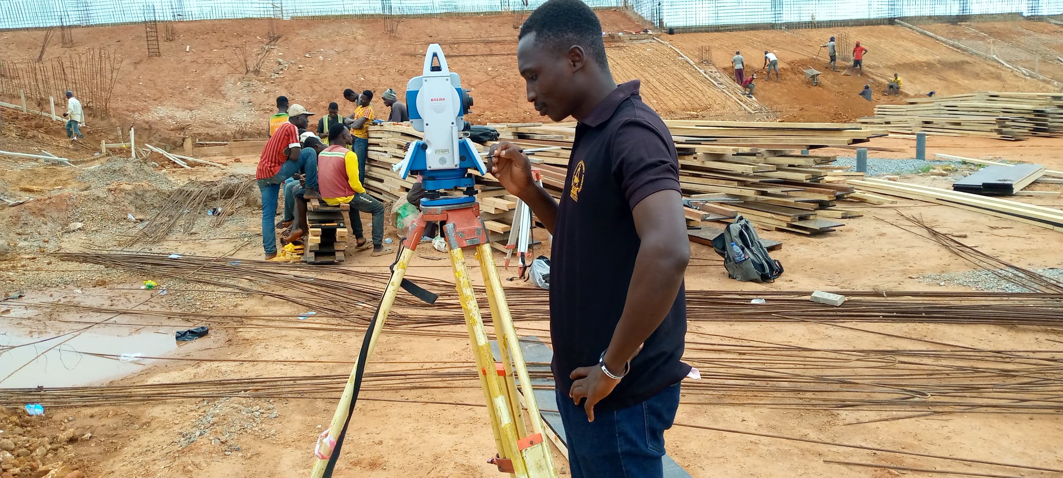
Subdivision & Topographic Survey
End-to-end field capture and drawings for a multi-lot development, delivered with construction set-out control.
View Case Study ➜Selected Work
Real outcomes across surveying, GIS, remote sensing, and AI. Here’s how we’ve helped teams plan, build, and decide with confidence.
End-to-end field capture and drawings for a multi-lot development, delivered with construction set-out control.
View Case Study ➜
Verification survey for civil works with formatted deliverables for approvals and asset handover.
View Case Study ➜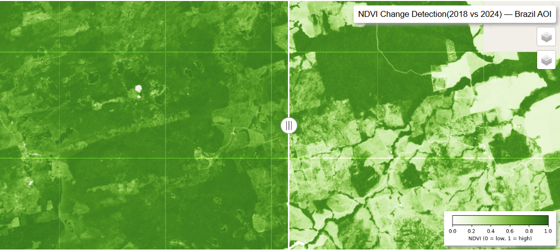
Monthly satellite monitoring with change detection and KPI dashboards for stakeholders.
View Case Study ➜
Drone + satellite fusion to quantify canopy change across estates and inform restoration plans.
View Case Study ➜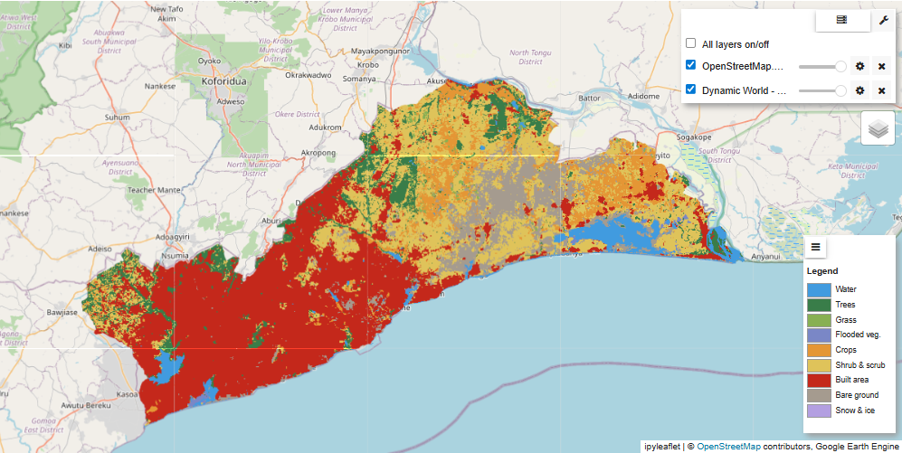
Pipeline for supervised classification (RF/KNN/CNN), with explainability and reproducible metrics.
View Case Study ➜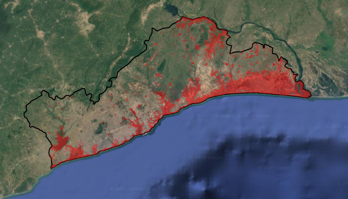
Predictive model using spatial features to highlight at-risk assets and prioritize inspections.
View Case Study ➜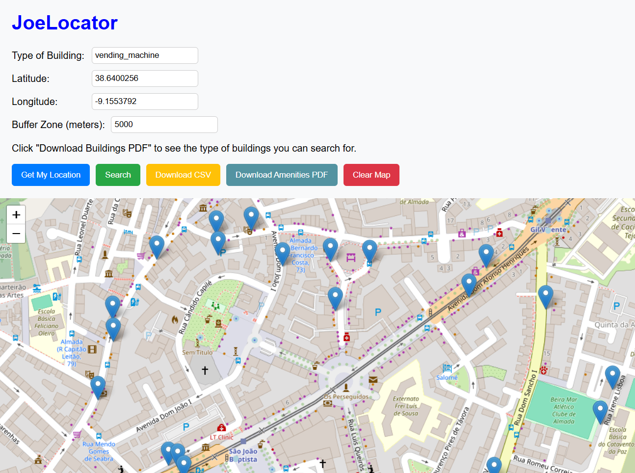
Role-based map application with scheduled ETL, letting teams self-serve reports and updates.
View Case Study ➜
Schema redesign and data migration to a governed enterprise geodatabase with versioning.
View Case Study ➜
Case Study — Surveying
Established control, captured detail with total station + GNSS, and produced CAD/GIS deliverables for approvals and construction set-out.
Case Study — Remote Sensing
Automated monthly monitoring of a large infrastructure site. Change areas were quantified and surfaced in a web dashboard used in weekly reviews.
Tell us your goals. We’ll map out an approach, timeline, and fixed deliverables.